Truth on the Ground: Precision Geospatial Analytics for the South Florida AEC Sector.
Engineering-Grade Accuracy
Target absolute vertical residuals of RMSE ≤ 0.1 ft. This precision matches traditional terrestrial grade-checking standards while providing millions of more data points.
Geometric Rigidity (RSC & Global Shutter)
We eliminate rolling shutter distortion through a combination of Mechanical Global Shutters and algorithmic Rolling Shutter Compensation (RSC).
Evidentiary Standards
Every data package is structured for a "Blind Audit". We withhold 3+ independent field checkpoints from processing to statistically prove the model’s accuracy to our P.E. partners.
Real-Time Situational Awareness

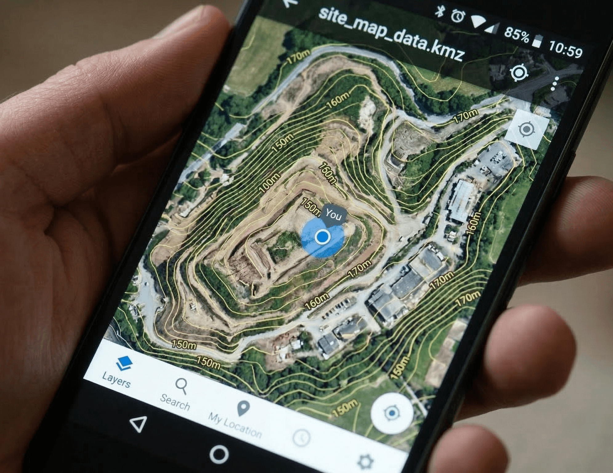
We deliver mobile-friendly .KMZ links synchronized to field GPS. Your site supers can verify elevations and site conditions directly on their phones—no specialized CAD software required for field verification.
For Civil Engineers:
High-precision B2B drafting bases delivered in 48 hours to maximize your firm’s throughput.
For Earthworks Contractors:
Verifiable “Rework Insurance” that identifies grading errors before the concrete pour.
- EXCELLENCE
- TRANSPARENCY
- HONESTY
- OPTIMIZATION
- STEWARDSHIP
Bottom Line Up Front (BLUF):
We are a values-driven organization dedicated to providing the definitive record of site conditions.